Friuli, one year on
Six PlanetScope comparisons between mid-August 2025 and mid-August 2026, from the Tagliamento river to the Grado lagoon, for a contribution published by Messaggero Veneto
by Piero Boccardo
On August 20, 2026, Messaggero Veneto published a satellite comparison on drought in Friuli Venezia Giulia, produced with PlanetScope imagery in collaboration with Piero Boccardo of the Politecnico di Torino: a year marked by heat waves interrupted by violent storms, with rainfall that “arrives but cannot strengthen our rivers.” As the newspaper’s headline put it, “from Spilimbergo to Manzano, the countryside is thirsty.”
This piece collects six PlanetScope comparisons taken between August 14–16, 2025 and August 16, 2026, from the middle course of the Tagliamento river down through the Friulian plain and out to the coast, from Udine and Palmanova to Monfalcone and the Grado lagoon: a further territorial extension of the same exercise already carried out on the Po basin and the Piave river in the summer of 2026 (see “The Po, one year on” and “The Piave, one year on”), applied here to Friuli Venezia Giulia, hit by the same drought season. Drag the vertical bar on each image to see before and after.
From the Tagliamento to the Friulian plain
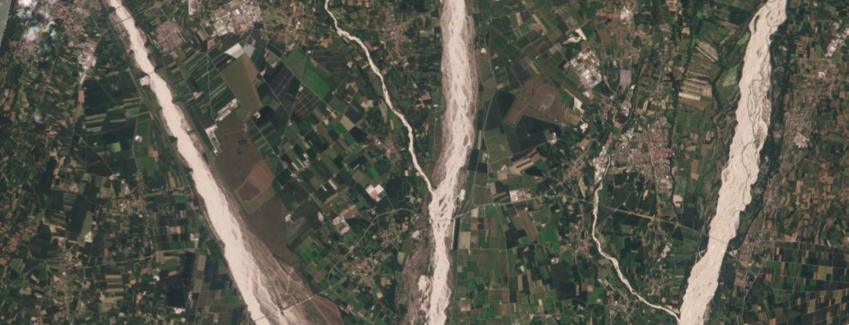
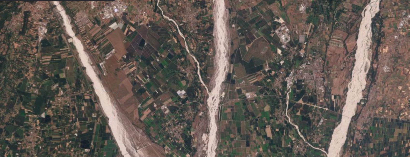
Figure 1 — Spilimbergo, August 16, 2025 / August 16, 2026. The Tagliamento near Spilimbergo, with its characteristic braided gravel bed, among the widest in Europe. The shape of the riverbed stays similar between the two dates, but the color of the farmland on both banks shifts sharply: from the green mosaic of 2025 to a wide predominance of brown, dry fields in 2026. Source: Planet Labs PBC.
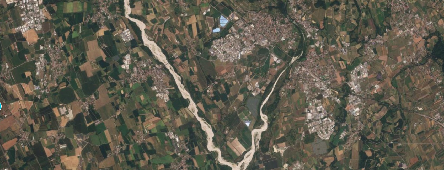
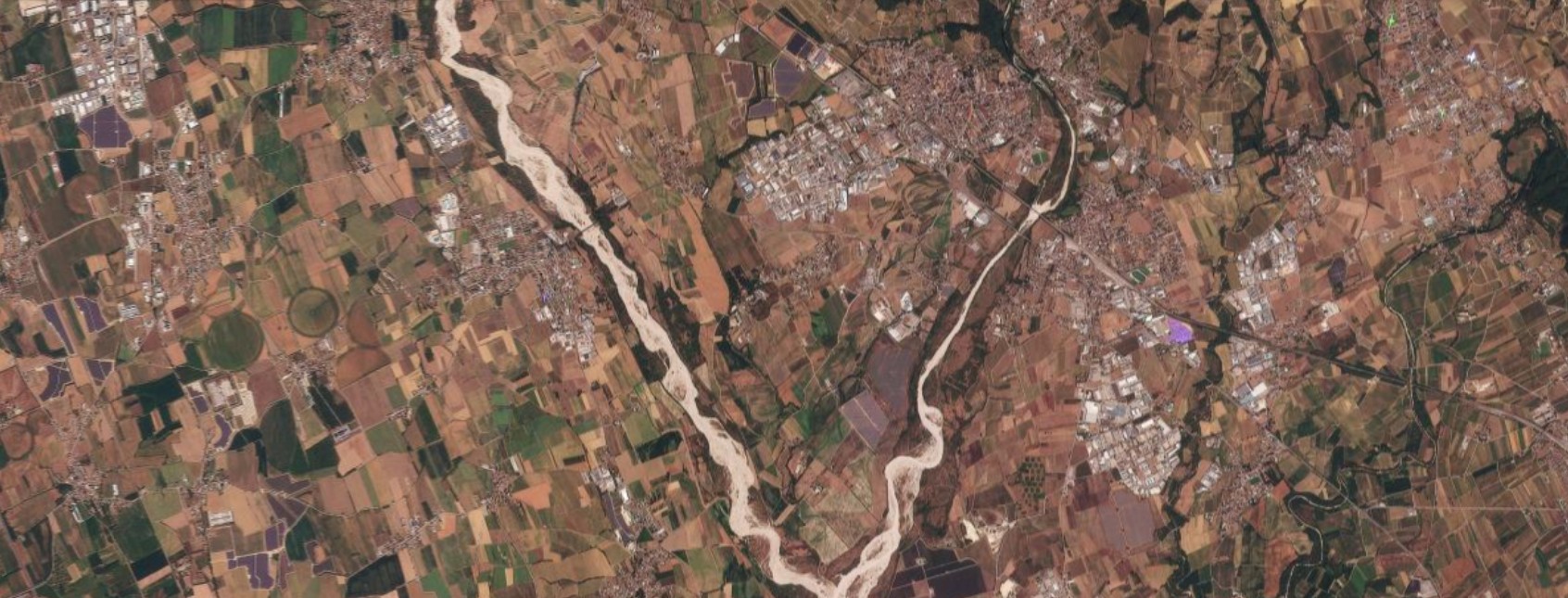
Figure 2 — Manzano, August 14, 2025 / August 16, 2026. Further east, in the Judrio area among the vineyards and fields of the Manzano district, the comparison shows the same color shift: the agricultural mosaic, mixed between green and brown in 2025, appears a year later dominated by brown tones, a sign of stressed vegetation and much drier soil. Source: Planet Labs PBC.
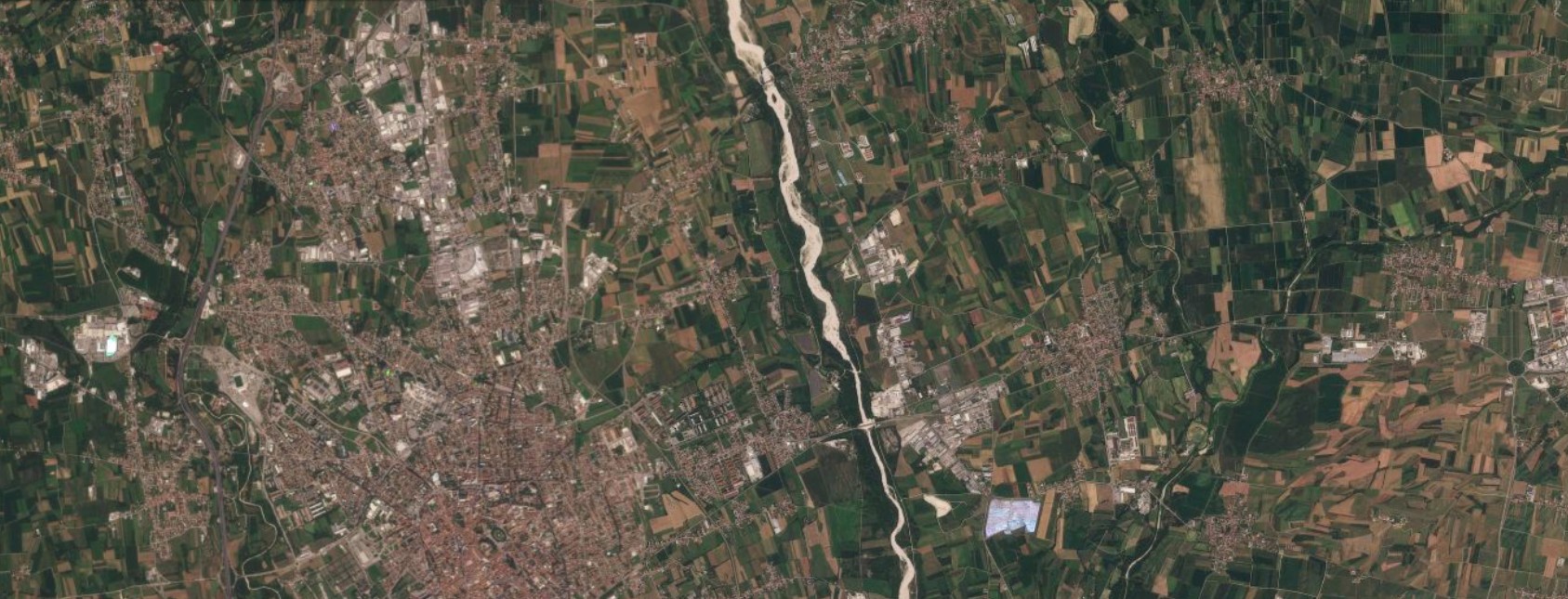
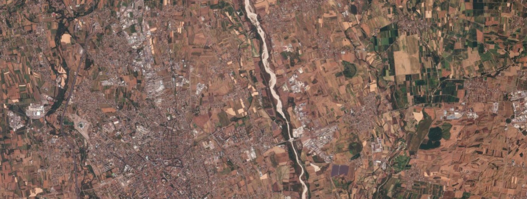
Figure 3 — Udine, August 14, 2025 / August 16, 2026. In the countryside surrounding the Friulian capital the change is among the starkest in the series: the built-up area of Udine is unchanged, but the fields that formed a mostly green mosaic in 2025 appear almost entirely brown in 2026, and the watercourse crossing the image looks narrower, with a more exposed gravel bed. Source: Planet Labs PBC.
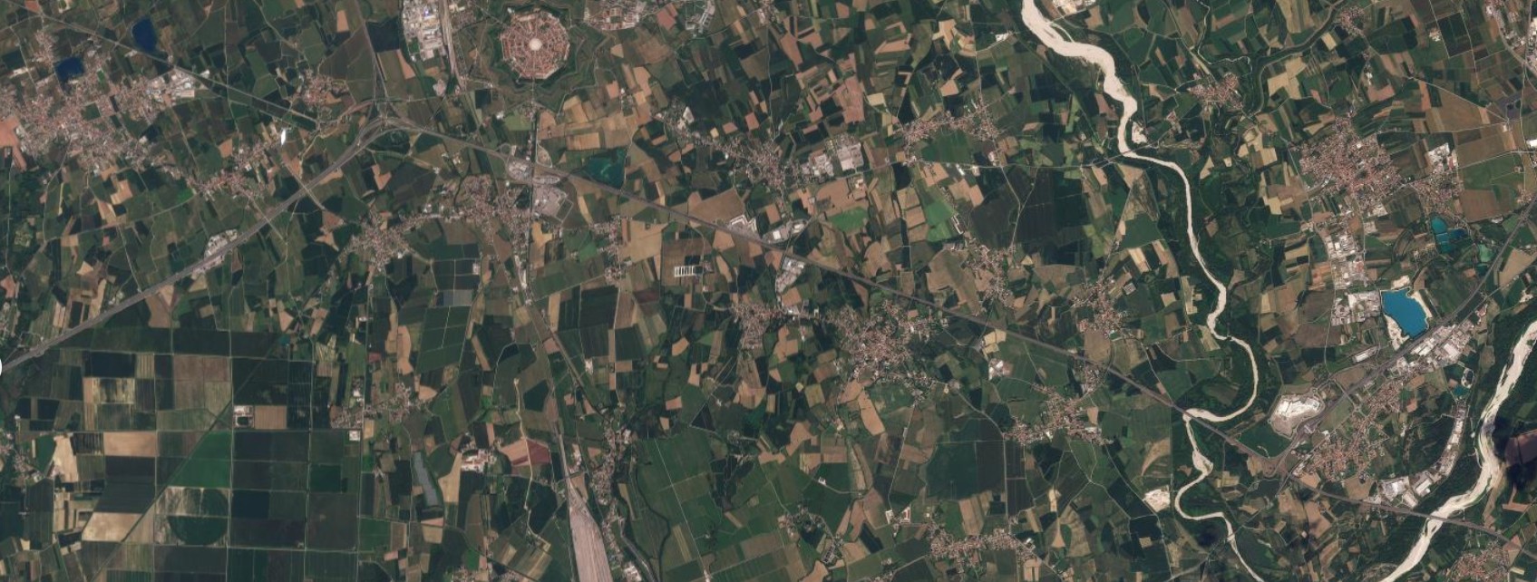
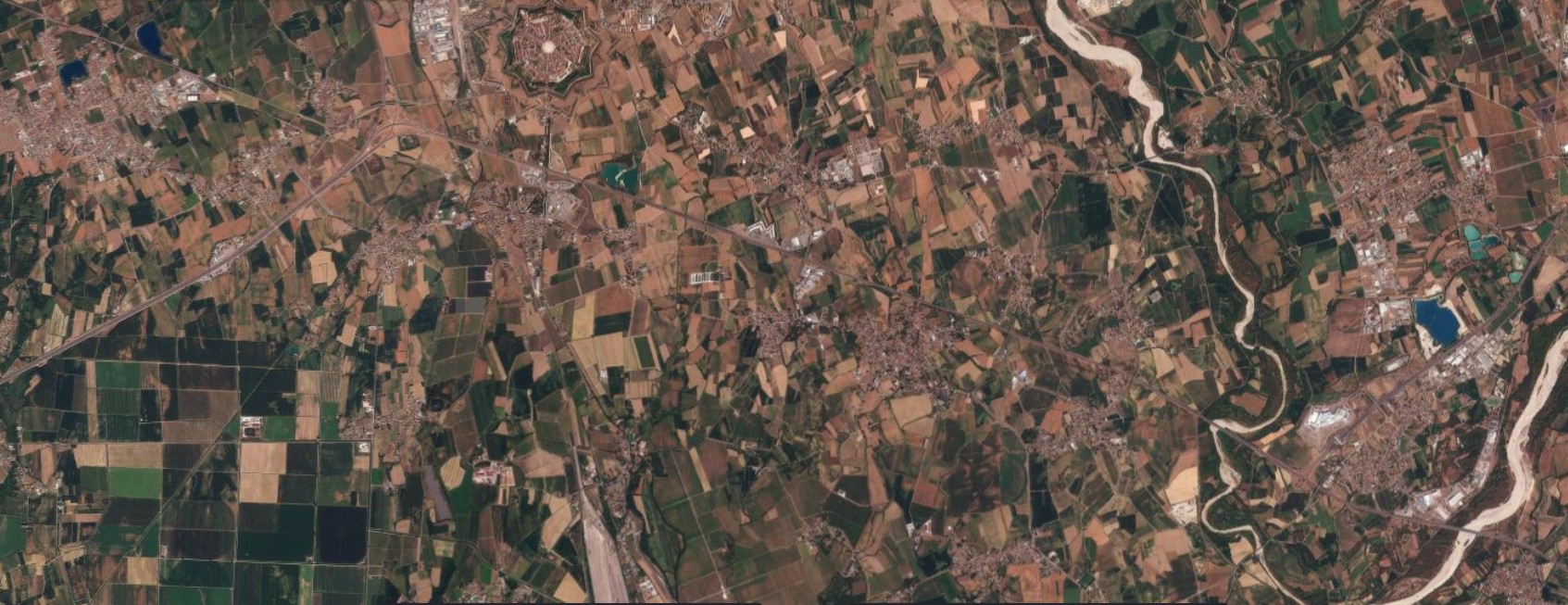
Figure 4 — Palmanova, August 16, 2025 / August 16, 2026. The town’s distinctive star-shaped fortress is naturally unchanged, but the surrounding countryside shifts color markedly: from the green-and-brown mosaic of 2025 to an almost entirely brown landscape in 2026, with the watercourse visible on the right reduced to a thin thread between wide, exposed gravel bars. Source: Planet Labs PBC.
Toward the coast: from Monfalcone to the Grado lagoon
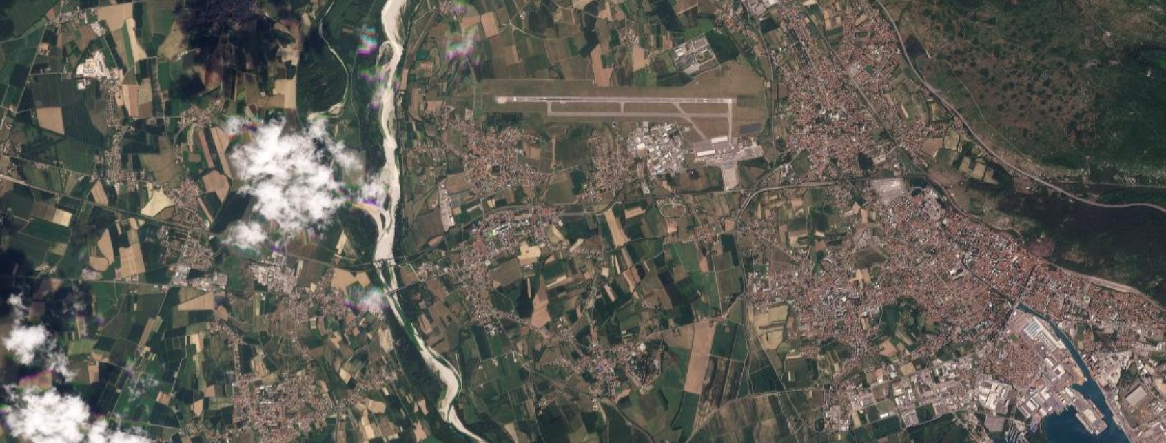
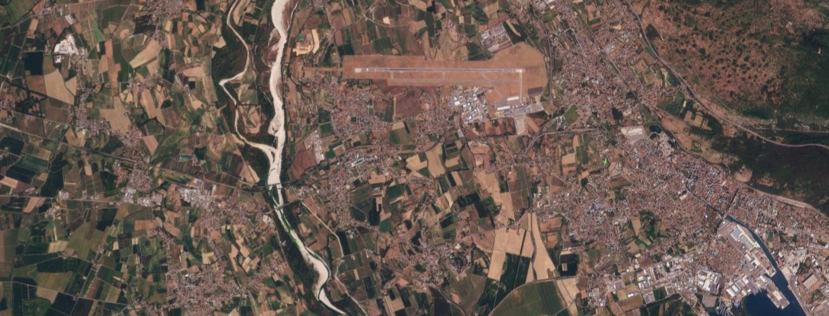
Figure 5 — Monfalcone, August 16, 2025 / August 16, 2026. The coastal stretch near Ronchi dei Legionari airport, with a watercourse running down toward the sea: in 2025 scattered clouds partly cover the fields to the northwest, but where the comparison is possible the same pattern seen further upstream appears, with farmland shifting from green to brown and the watercourse’s bed more exposed in 2026. Source: Planet Labs PBC.
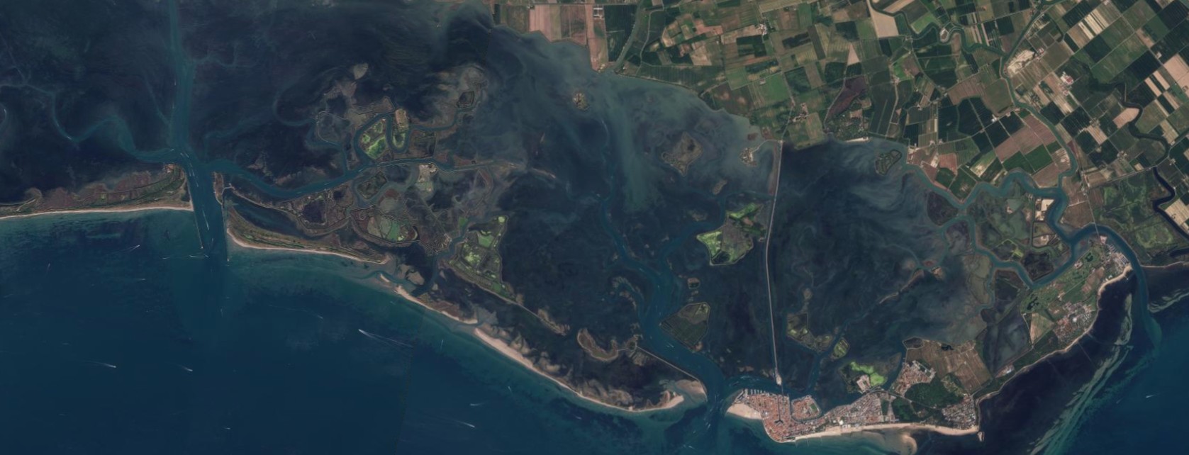
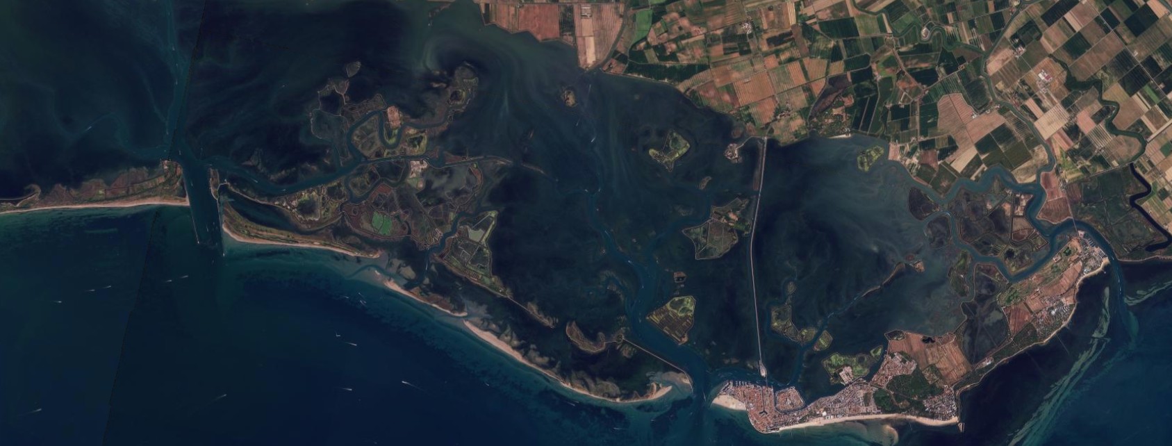
Figure 6 — Grado, August 16, 2025 / August 16, 2026. The last comparison in the series moves to the Grado lagoon, at the mouth of the Isonzo-Aussa-Corno system: here the drought signal is less immediate than in cultivated fields, since the shape of the channels, marsh islands and sandbars stays largely the same between the two dates. The most readable change again lies in the cultivated land in the northeastern corner of the image, browner in 2026. Source: Planet Labs PBC.
Sources: Messaggero Veneto, “Un anno di siccità cambia i colori del Friuli Venezia Giulia: il prima e il dopo con le immagini satellitari” (August 20, 2026); PlanetScope analysis produced in collaboration with Piero Boccardo, Politecnico di Torino.