The fire seen from orbit
The Monte Faeta wildfire between Lucca and Pisa, documented day by day with PlanetScope and SkySat imagery
by Piero Boccardo
Content to be added.
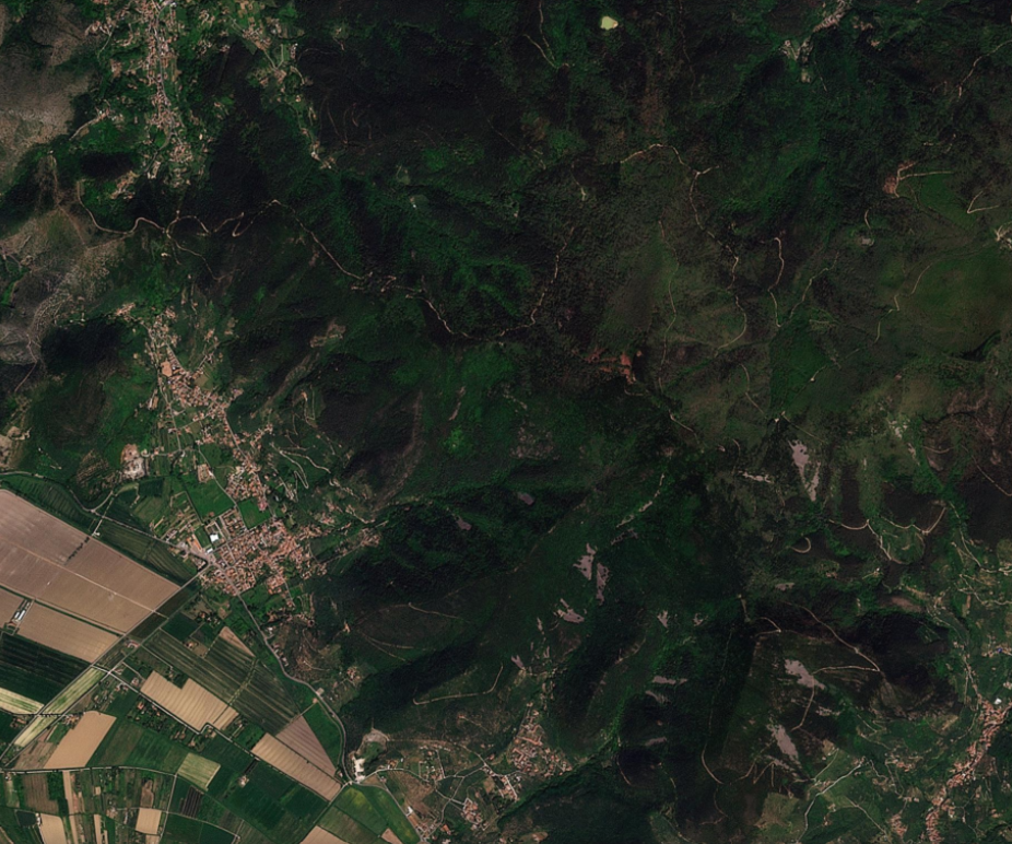
Monte Faeta, 25 April 2026. PlanetScope image acquired before the fire started: forest cover is intact and no thermal anomalies are recorded. — Planet Labs / PlanetScope
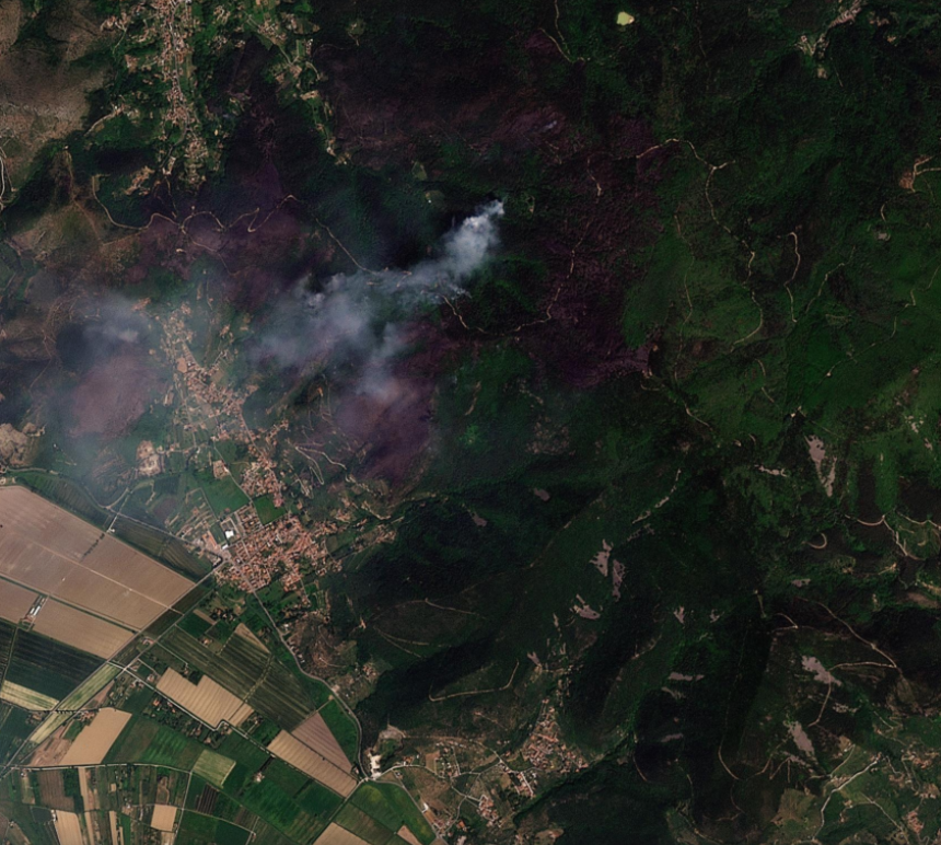
Monte Faeta, 1 May 2026. PlanetScope: the fire front and smoke column are clearly visible. The fire has already burned hundreds of hectares of woodland across the Lucca and Pisa slopes. — Planet Labs / PlanetScope
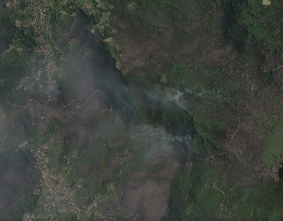
Monte Faeta, 1 May 2026. High-resolution SkySat image: the detail allows the active fire front to be distinguished from areas already burned (darker). The forest roads used for firefighting operations are visible. — Planet Labs / SkySat
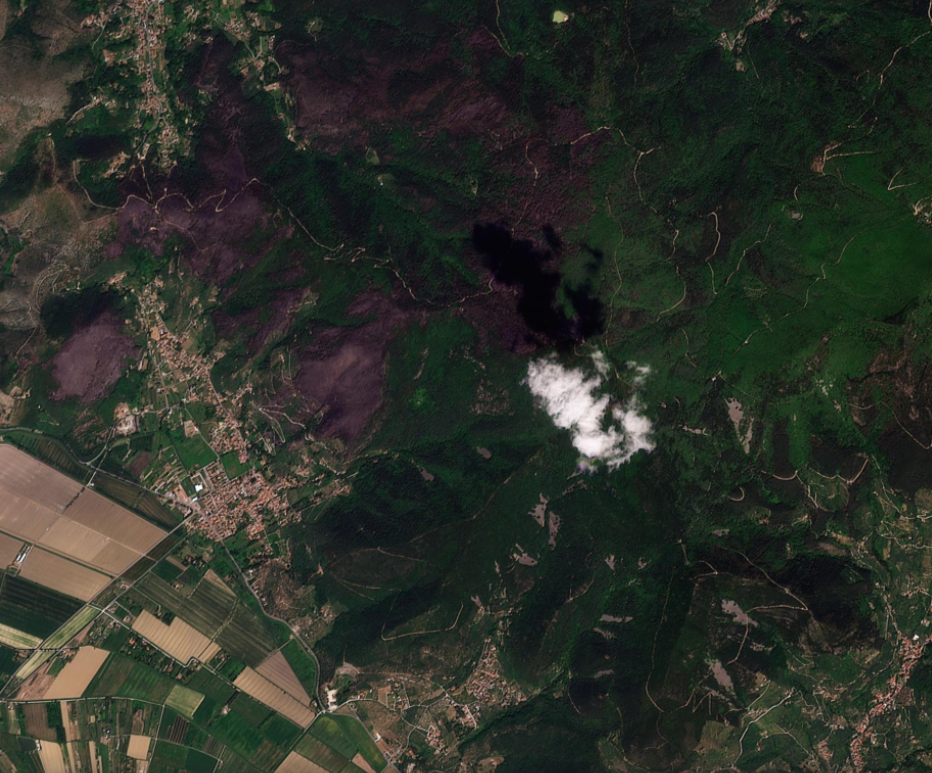
Monte Faeta, 2 May 2026. The woodland burned by the fire stands out clearly from the surrounding intact vegetation. The burned area, estimated at over 800 hectares, can be measured with precision from orbit. — Planet Labs / PlanetScope