The Piave, one year on
Seven PlanetScope comparisons between mid-August 2025 and mid-August 2026, from the Treviso foothills to San Donà di Piave, for a contribution published by Il Mattino di Padova
by Piero Boccardo
On August 19, 2026, Il Mattino di Padova published a satellite comparison on drought in the Veneto region, produced in collaboration with Piero Boccardo of the Politecnico di Torino: a year of heat waves interrupted by violent but insufficient storms, with the Piave river running dry at several points between Valdobbiadene and San Donà di Piave. As the newspaper put it, “the color palette shifts from green to brown, visually demonstrating the water hunger of fields and crops.”
This piece collects seven PlanetScope comparisons along the course of the Piave, taken almost always between August 14–16, 2025 and August 16, 2026, from the Treviso foothills down to the plain near Venice: a territorial extension of the same exercise already carried out on the Po basin in the summer of 2026 (see “The Po, one year on”), applied here to a different river and a different region — eastern Veneto — hit by the same drought season. Drag the vertical bar on each image to see before and after.
The upper Piave: from the foothills to the Treviso plain
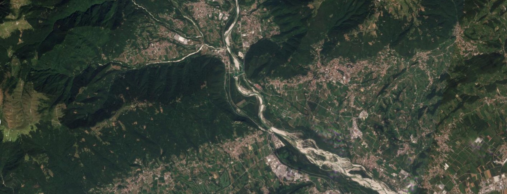
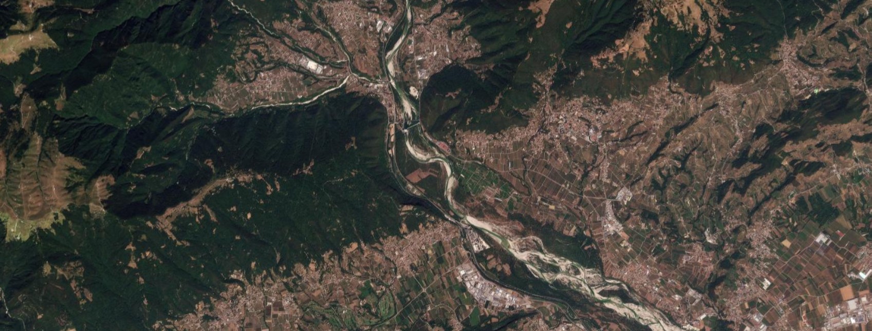
Figure 1 — Valdobbiadene, August 14, 2025 / August 16, 2026. The point where the Piave leaves the Treviso foothills and enters the Valdobbiadene basin. The river’s gravel bed remains wide in both images, but the color of the surrounding hillsides and valley-floor fields changes sharply: from the widespread green of 2025 to much more extensive brown tones in 2026, the same “color shift” described by Il Mattino di Padova. Source: Planet Labs PBC.
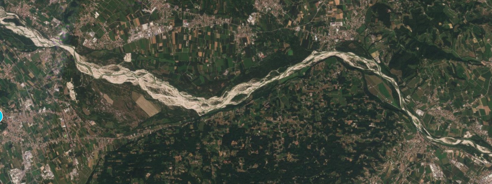
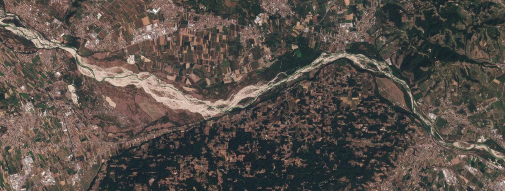
Figure 2 — Bosco di Vidor, August 14, 2025 / August 16, 2026. A little further downstream, near the Bosco di Vidor, a riparian woodland along the river. In 2026 the farmland surrounding the wood appears largely brown in place of the compact green of 2025, and even the forest patch that gives the place its name shows a lighter, more uneven canopy than the year before. Source: Planet Labs PBC.
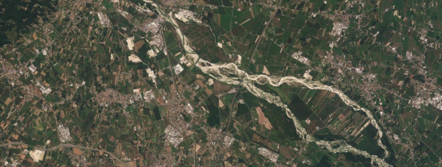
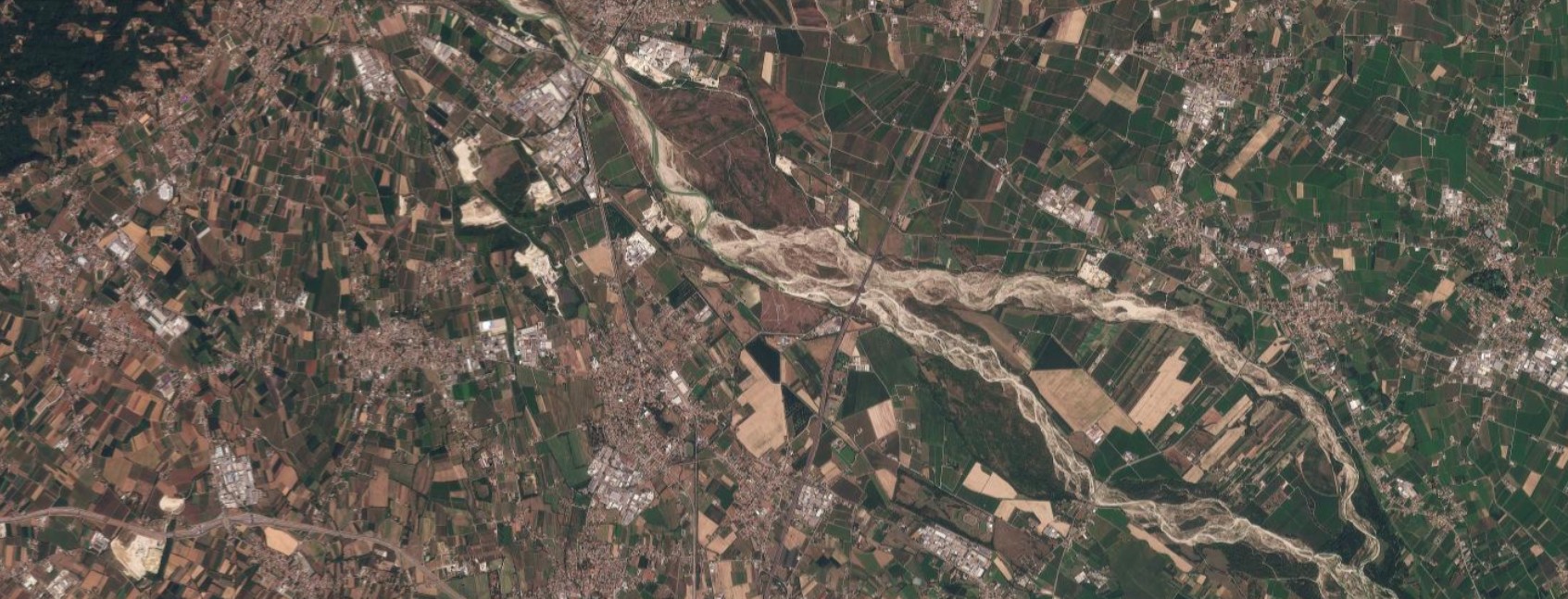
Figure 3 — Spresiano, August 14, 2025 / August 16, 2026. The foothill stretch of the Piave near Spresiano, with its characteristic braided gravel bed. The shape of the riverbed changes little from one year to the next, but the surrounding agricultural mosaic shifts from a balance of green and brown in 2025 to a clear predominance of brown fields in 2026. Source: Planet Labs PBC.
The lower Piave: toward San Donà and the plain near Venice
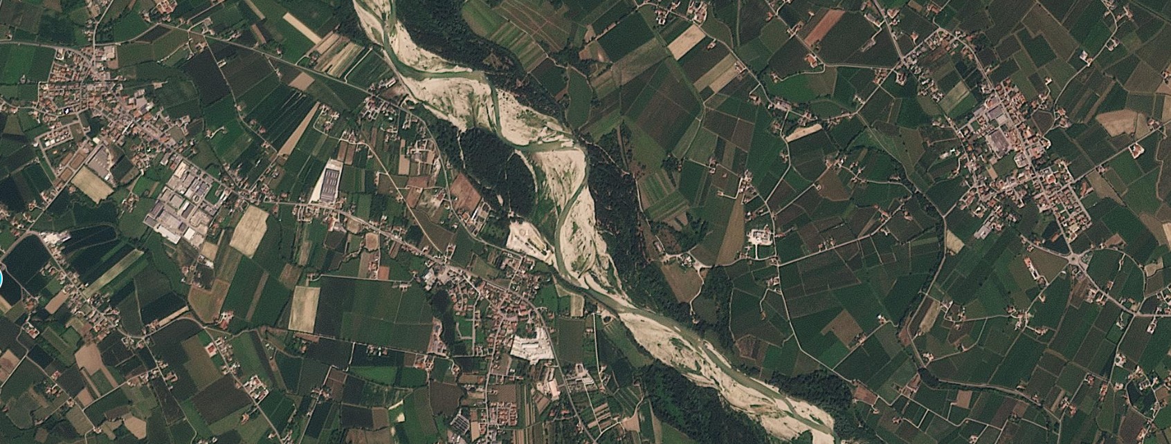
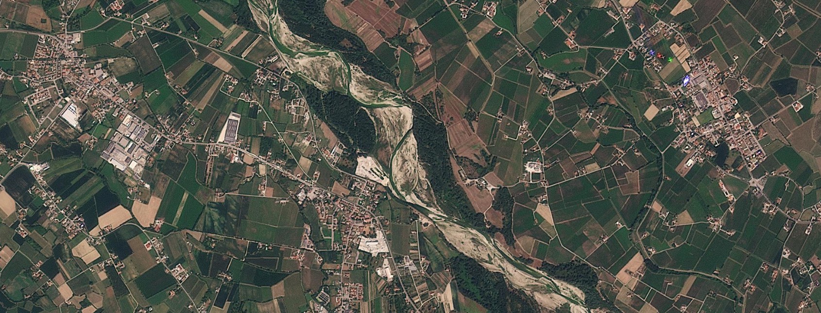
Figure 4 — Saletto, August 14, 2025 / August 16, 2026. Near Saletto the Piave keeps its characteristic braided channel with wide central gravel bars in both dates. The clearest difference again lies in the farmland on both banks, browner and drier in the 2026 image. Source: Planet Labs PBC.
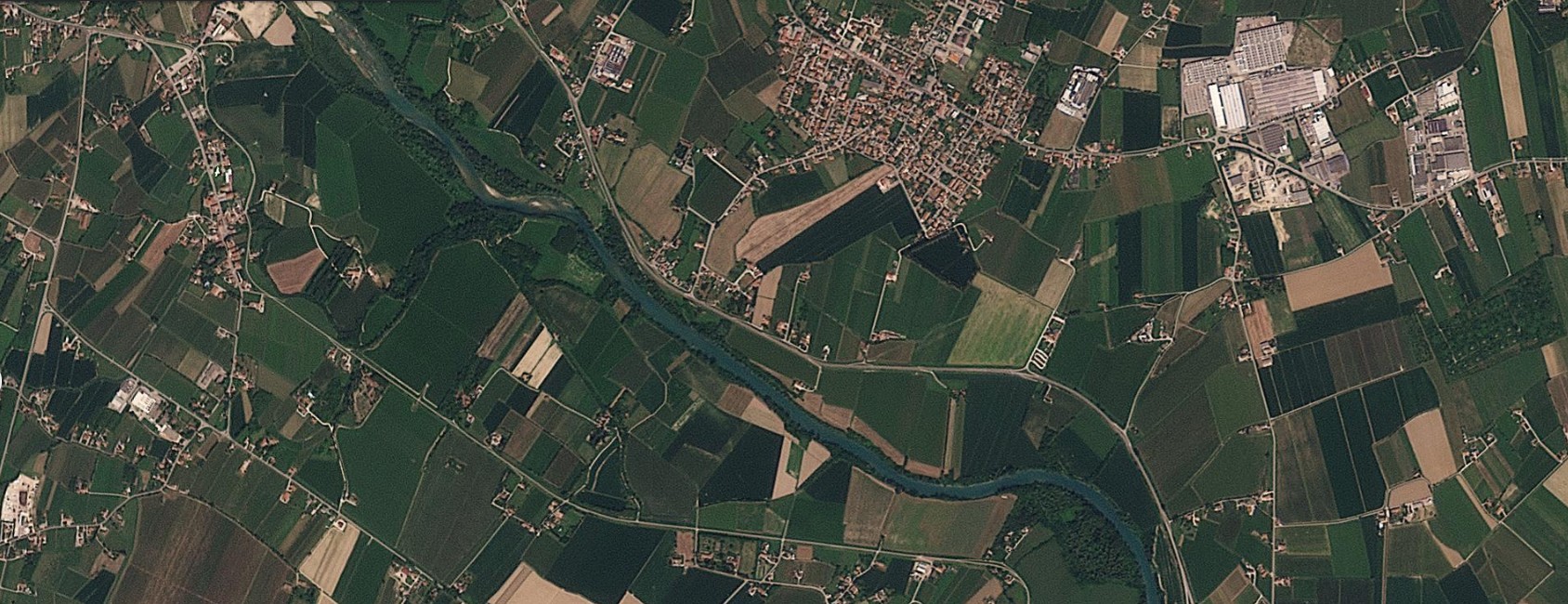
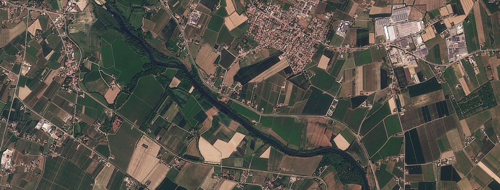
Figure 5 — Salgareda, August 16, 2025 / August 16, 2026. At Salgareda the Piave already flows in a single, embanked channel, without the gravel bars seen further upstream: here the drought signal shows mainly in the fields, with a larger extent of brown plots in 2026 compared with the greener mosaic of 2025. Source: Planet Labs PBC.
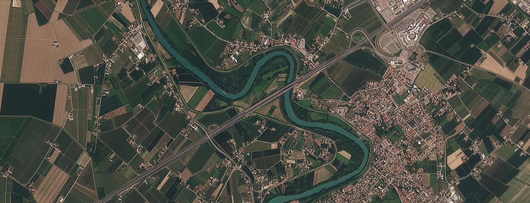
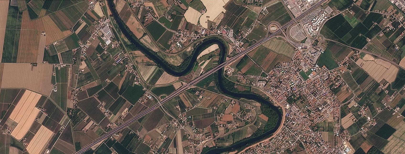
Figure 6 — Noventa di Piave, August 16, 2025 / August 16, 2026. A wide river bend a short distance upstream of San Donà, with the large farm plots typical of the lower Venetian plain. The comparison shows how the largest fields, mostly green in 2025, turn significantly browner a year later. Source: Planet Labs PBC.
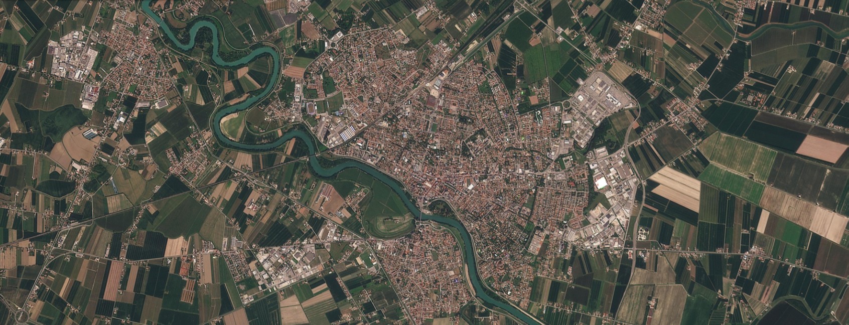
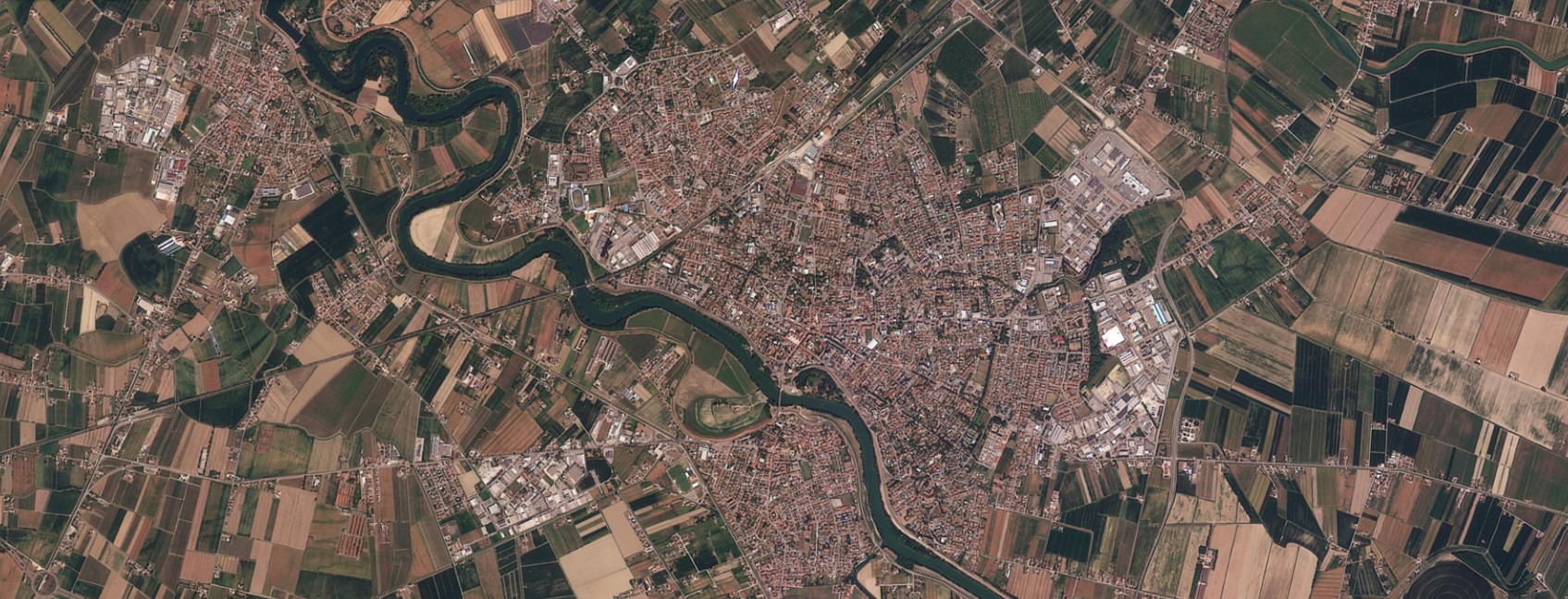
Figure 7 — San Donà di Piave, August 16, 2025 / August 16, 2026. The last comparison in the series, in the town center of San Donà di Piave, where the river traces a wide bend through the town. The built-up area does not change, but the riverside vegetation and the fields just outside the town appear overall browner and more stressed in the 2026 image. Source: Planet Labs PBC.
Sources: Il Mattino di Padova, “La siccità vista dal satellite: com’è cambiato il Veneto in un anno” (August 19, 2026); PlanetScope analysis produced in collaboration with Piero Boccardo, Politecnico di Torino.